Now Available with FCC, CE, and MIC Certifications!
Visit our shop to order your RTLS today!
UWB & RTLS
How Ultra-Wideband powers high-precision Real-Time Location Systems
What is RTLS?
Real-Time Location System (RTLS) is a system that identifies and tracks the location of objects or people in real-time, within a defined area. RTLS solutions combine hardware, such as anchors and tags, with software algorithms that calculate and display precise locations.
What is UWB?
Ultra-Wideband (UWB) is a wireless communication technology that operates by transmitting data across a broad frequency range using extremely short pulses. This wide frequency spread allows UWB to achieve high data transfer rates while using very low power, making it highly efficient for short-range communications. Unlike traditional wireless technologies that operate on narrow frequency bands, UWB's pulse-based approach reduces interference with other signals and provides a unique ability to transmit large amounts of data quickly and securely.
A defining feature of UWB is its precision in determining distance and location. By measuring the time it takes for signals to travel between devices, UWB can calculate distances with centimeter-level accuracy, making it ideal for applications requiring fine-grained spatial awareness. Its low power consumption is another advantage, enabling energy-efficient operation in battery-powered devices. UWB’s robustness against interference and its ability to coexist with other wireless technologies make it a versatile solution for modern technological challenges.
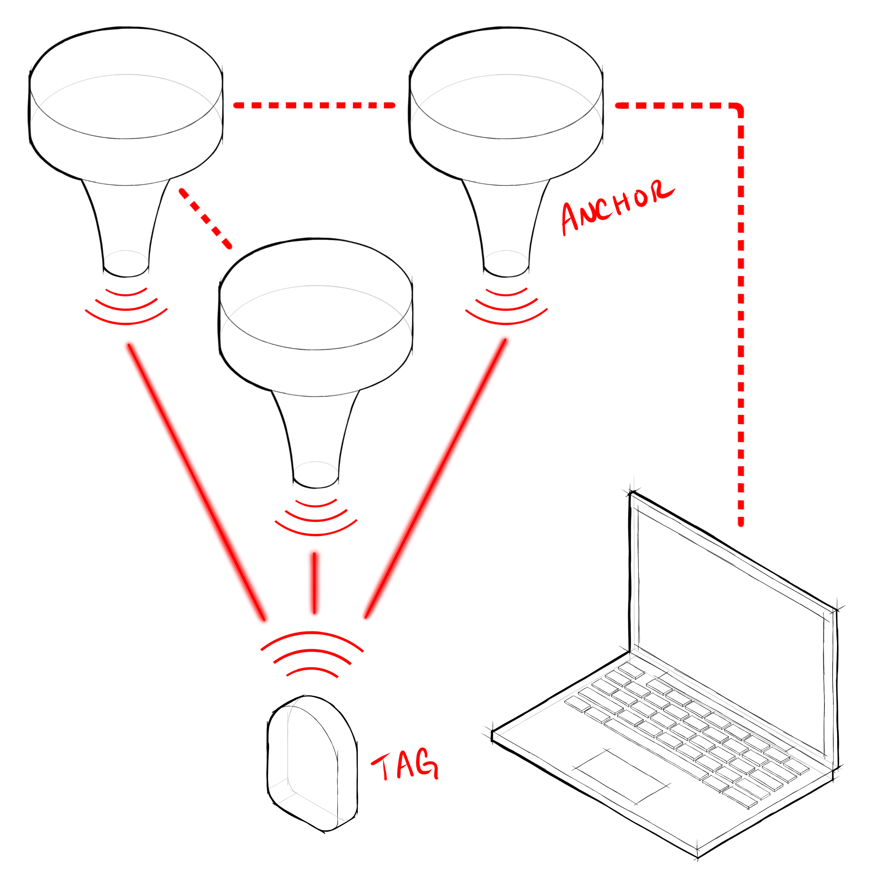
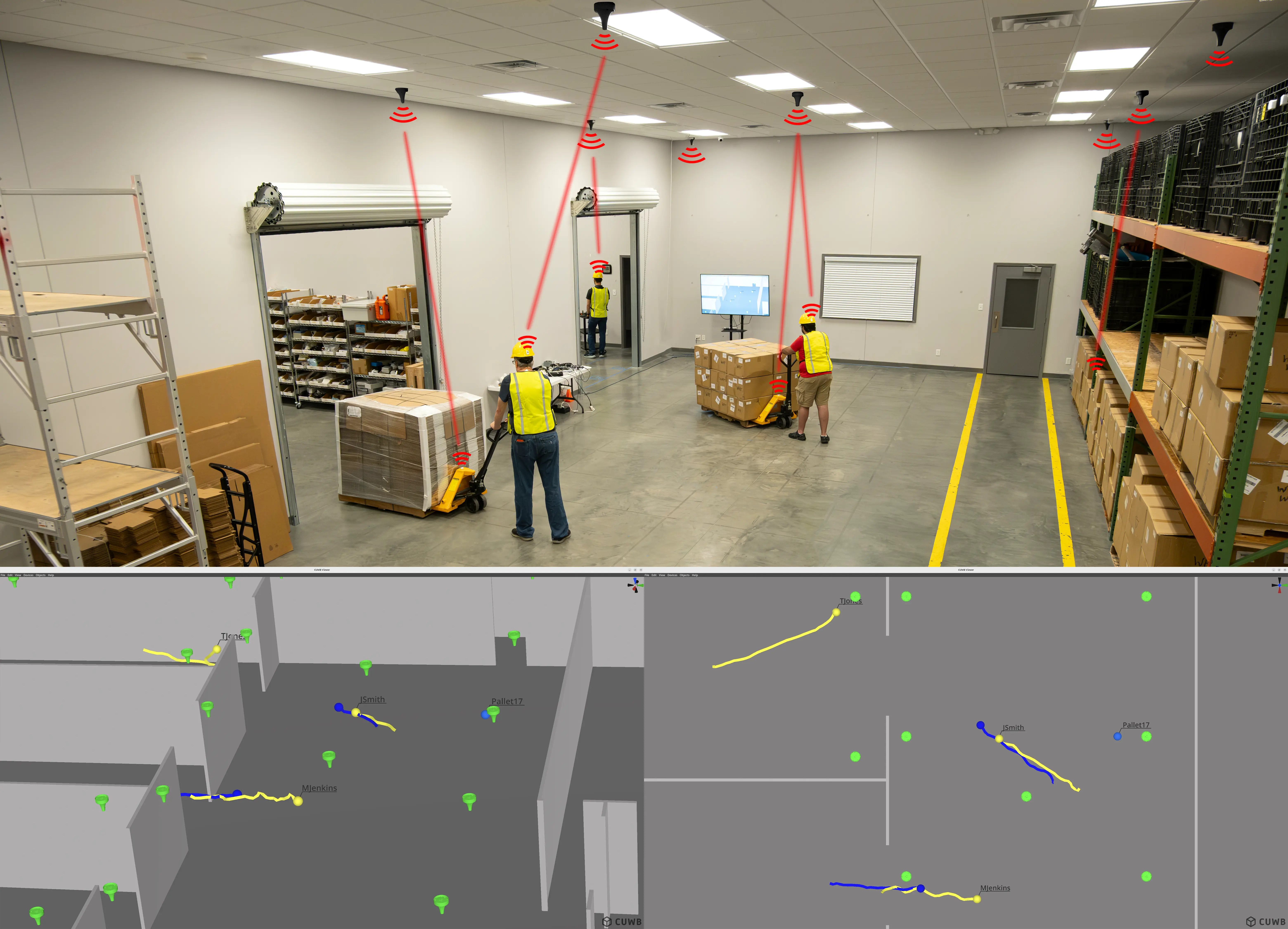
UWB and RTLS Together
When UWB is used as the communication layer for an RTLS, the result is precise, reliable, low-latency, and power-efficient location tracking. Anchors measure the signal timing from each tag and forward it to the software engine, which calculates real-time positions. By leveraging UWB’s strengths, CUWB systems scale seamlessly from small labs to large industrial facilities, delivering consistent, high-performance results.
Anchors are the fixed reference points of an RTLS. Typically mounted on ceilings or walls, they are carefully surveyed to provide stability and accuracy. All system components rely on anchors to calculate tag locations.
Tags are the mobile, trackable elements of the RTLS. Attached to tracked assets, tags communicate with anchors to continuously calculate and report precise location data
The CUWB Manager is the control software for the RTLS. It communicates with anchors and tags, calculates positions, and provides system-wide configuration and monitoring.
The CUWB API delivers location data directly through IP Protocol to your applications. Position information can also be viewed in CUWB Manager or CUWB Viewer, but the API makes integration with third-party systems simple and flexible.